Corresponding Practices and Mappings


'[T]he political economy of archaeology determines and limits how we move, act, produce and value our work and the products of our peers. Thus, heavy contextualization, justification and explicit explanation weigh down most (perhaps all) standard and highly respected archaeological work.' (Bailey 2017: 249).


'[H]umans should be able to become [participants] in the dynamics of the world to the extent that he [or she] can recover the sense that things [and words] are potentialities which manifest themselves and their endless kinetic energies as both object and nouns […]. Art does not seek to describe but to enact.' (Byrd 1980: 74–75).


Archaeology and Art in combination provide a fertile research context. By going beyond specific disciplinary methods and into practice on a landscape scale, this exposition considers landscape survey methods and archaeology and poetics as complementary approaches (Bailey 2017; Thomas et al. 2017; Wall and Hale 2020). Archaeology and poetry immerse archaeologists and artists in a shared fieldwork project in order to reveal the performative and embodied materiality of what landscapes can make of us.

In the above quotation, Doug Bailey (2017) suggests a removal of the weight from archaeological practice to allow broader forms of archaeology to emerge not as weightless things, but as something that is not held by the traditional economy, nor disciplinary boundaries. Our project enacts a poetic approach towards an opening or wilding of language and archaeological surveys, in this particular case, based on LiDAR-derived digital datasets.

Planning meeting on-site at the Kilmartin Museum, 11th March 2019.

Our use of the terms ‘wilding’ or ‘re-wilding’ throughout owes a direct debt to:

  1. the landscape re-wilding movement, which seeks to turn our systems of production and signification away from reductive or monocultural conceptualisations and readings of landscape, towards practices that accommodate the possibilities, both of an enchantment and a more respectful approach to nature (Monbiot 2013; Morton 2010);
  2. attempts to free, open and re-wild Western consciousness through a reorientation of the roots of language as found in the writings of a number of twentieth-century philosophers – Blanchot, Derrida, Foucault, and Lyotard – and those linguistic re-articulations of perception that are to be found within eco-poetic movements (Hinton 2017). These are a diverse set of attitudes that specifically seek to reorient our understanding of thought so that it may again be driven by nature, rather than nature being driven by our thoughts (Otten 2020).

Planning the day of survey, from the field office; a Land Rover. Morning, 12th March.

The context of our own research project was that of the Kilmartin Glen research and development project of 2019 which combined LiDAR datasets with poetic action to survey and record extant surface archaeologies as part of the ongoing HES Rapid Archaeology Mapping Programme (RAMP). Part of the aims of the programme are to confirm what is in a landscape (both on the ground and through digital datasets) and draw it into a national archive, the NRHE. While acknowledging the complexities that appear through inter-disciplinary working, this approach of embedding an artist/poet into an archaeological survey team provided opportunities for critical reflection on processes, signification and interpretations through our creative assemblages of shared experiences walking the landscape, note-taking (site writing), photography and conversations on-site, and between disciplinary practitioners.

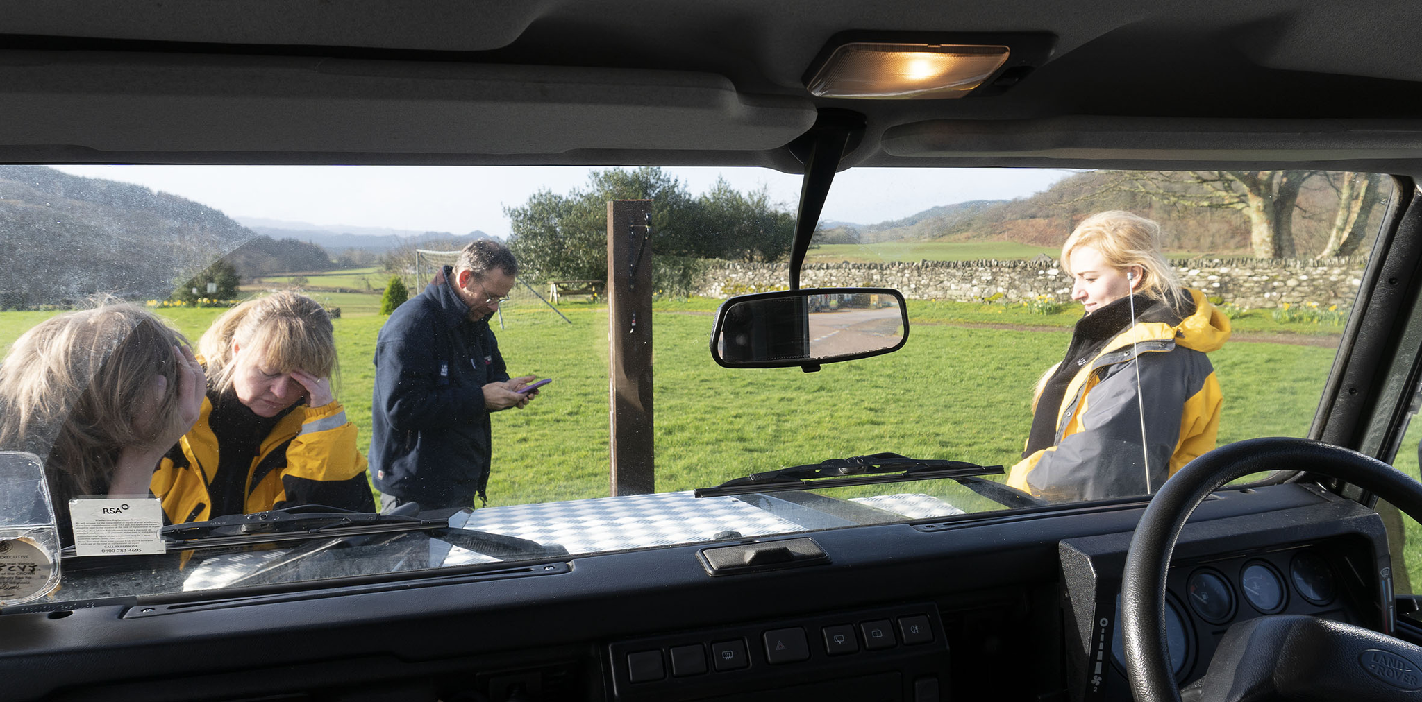
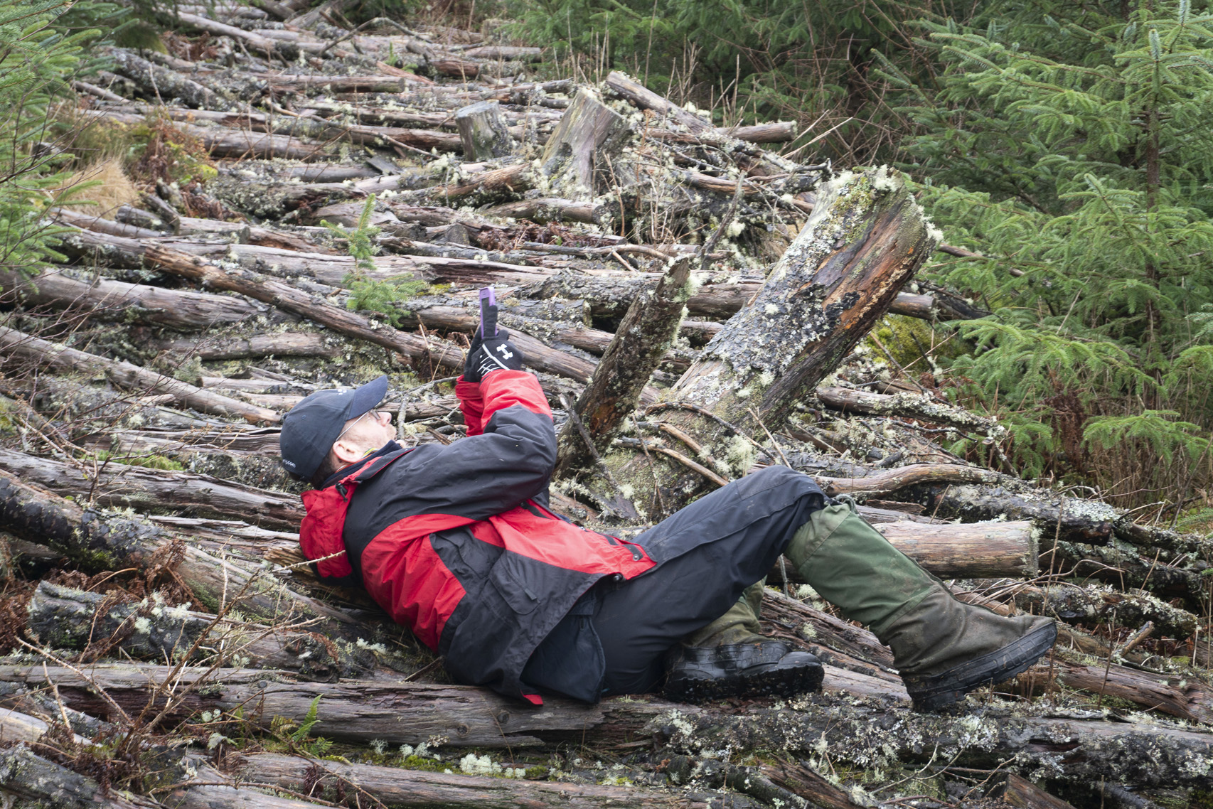
Our fieldwork in Kilmartin was conducted between 11 and 14 March 2019, and involved archaeologists from HES, along with the artist and poet, Jim Harold. The days of the survey coincided with periods of extreme weather occasioned by Storm Gareth, and conditions were, therefore, difficult and unpredictable: from rain, to sleet, high winds, and bitter cold.

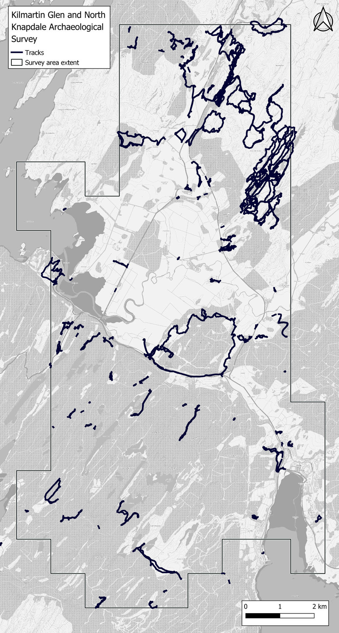
The Kilmartin survey was undertaken within a research and development phase of RAMP at HES at the time of writing. The programme was instigated in 2018 with an objective to ‘explore economic and rapid methods to enrich the NRHE in ways that benefit all users […] drawing on remote sensed data’ (HES 2019a). Within it, a number of test locations have been surveyed, by applying a developing methodology that relies heavily on airborne laser scanning derivatives and orthophotographs (Banaszek et al. 2018). The remote sensing data is being utilised to demonstrate the potential for ‘identifying, recording, understanding and interpreting the historic environment’ (Cowley et al. 2020: 109) through rapid survey methods in order to provide a methodology for heritage agencies with managerial and policy responsibility for the historic environment, and it was within this context that we operated.

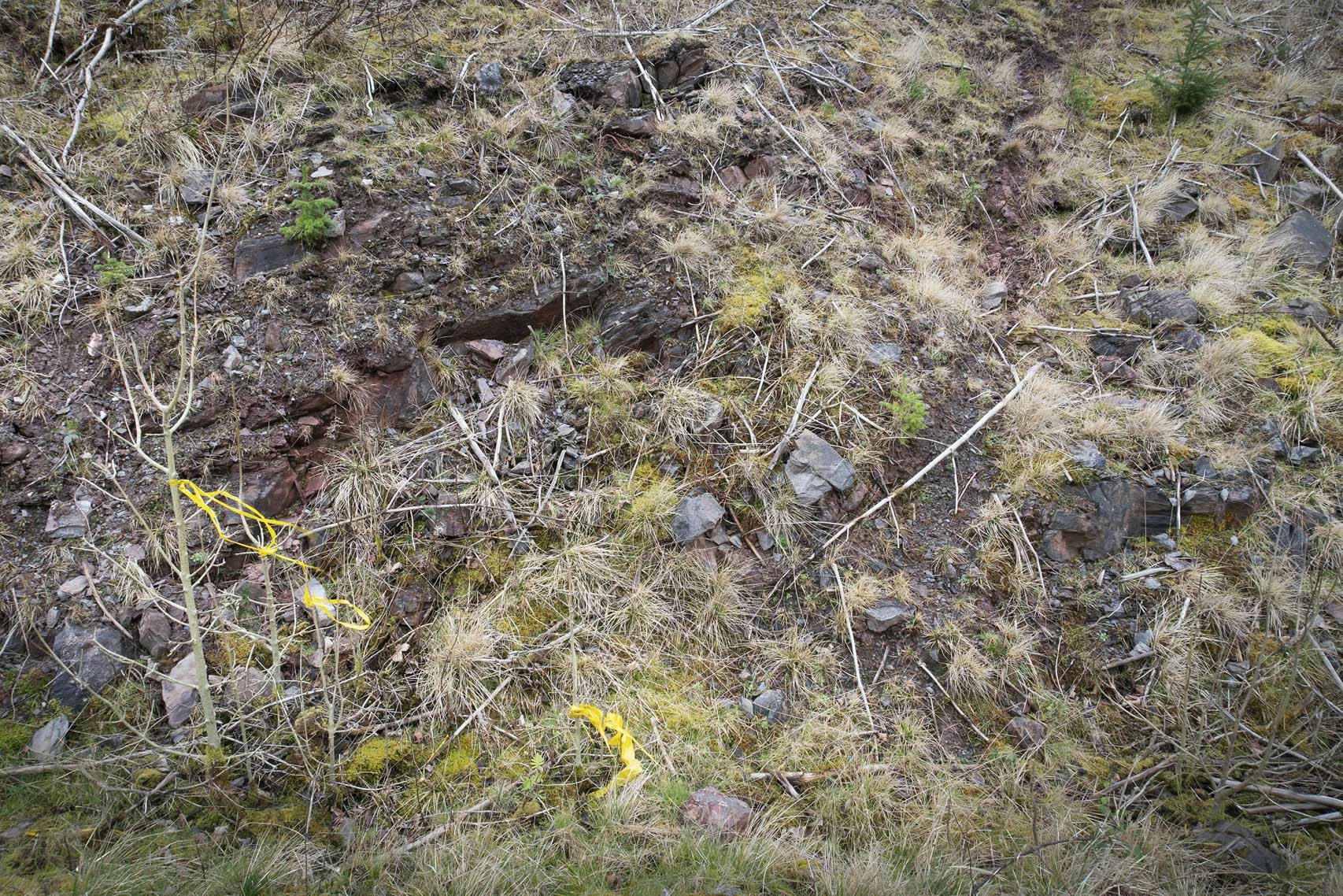
Specifically, the RAMP Kilmartin survey was based on two sets of high-resolution airborne laser scans covering some 110 square kilometres, alongside overlapping data covering adjacent areas in a lower resolution. The project foregrounded remote sensing and the fieldwork aimed to visit sites where there was ambiguity or a low level of confidence as to the nature of the interpretation of the digital information. The survey methodology defined specific features that would form the focus of the data-gathering (HES 2019b).

Lukasz Banaszek and Jim Harold standing beside the remains of a Bronze-age cairn. Looking south in the rain across Kilmartin. 13th March.

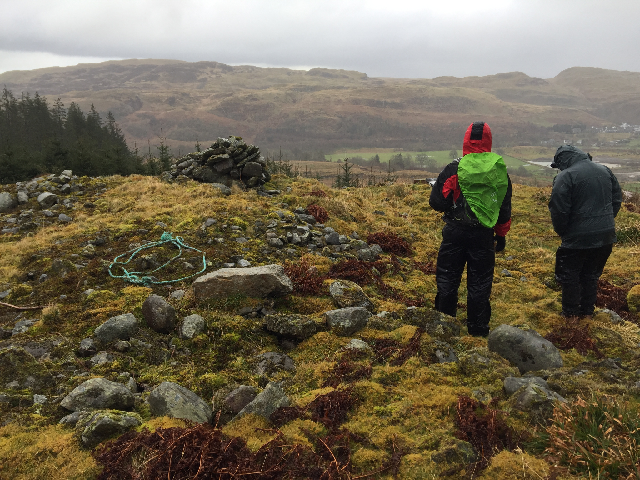
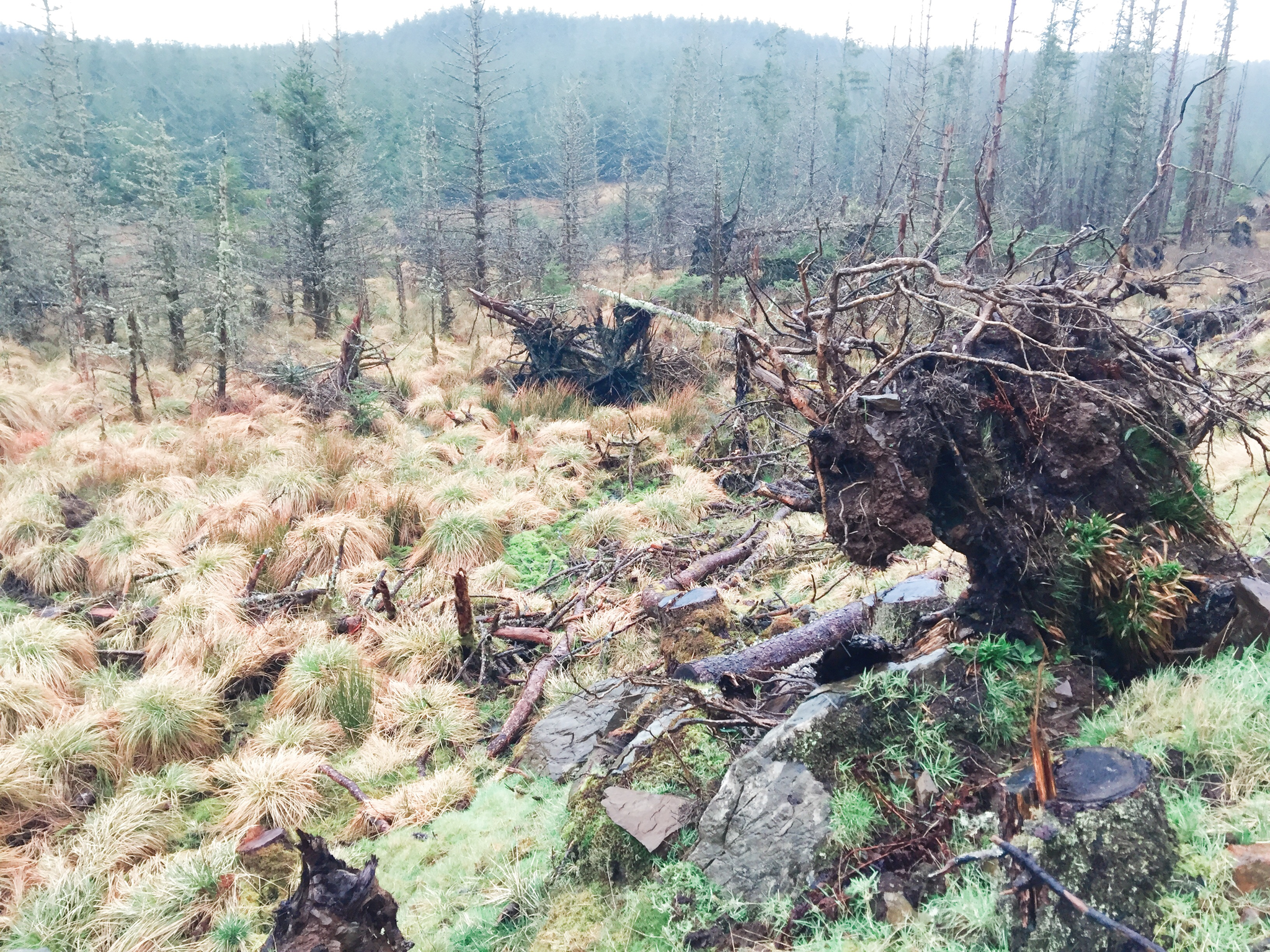
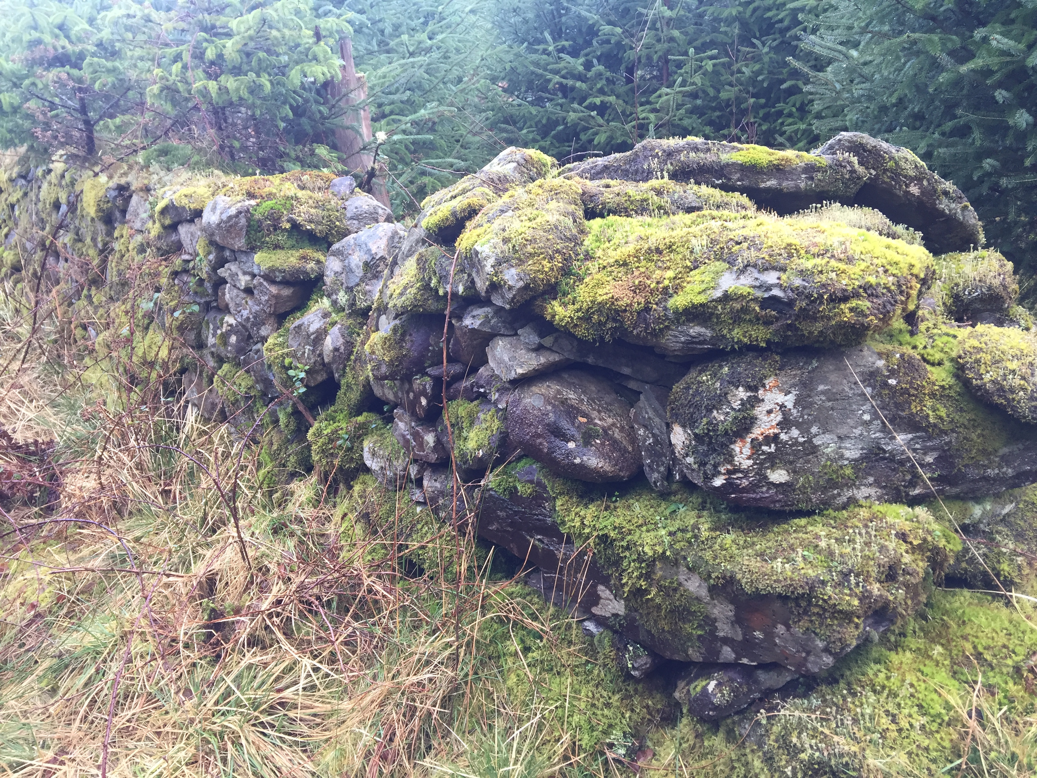
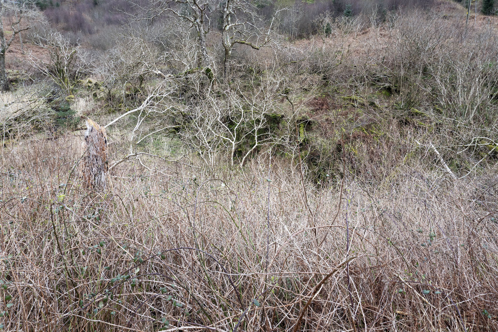
The landscape itself, while not forming a documented part of the RAMP survey beyond any topographic positioning, was navigated and, in many senses, negotiated with. The glaciated glen that leads up from Lochgilphead and the Mòine Mhòr drifts from peat bog into farmland while the hills, rising to some 450m, are densely planted with commercial forestry. Rainfall drains from these hills, down into the River Add, and then out to the Sound of Jura and the sea. Over the three days of our fieldwork, we were mainly searching targets within the forestry lands. Beginning each day in proximity to the Kilmartin Museum, a temporary base and re-grouping point, before travelling south and west to the trapped valleys close to Crinan – our first day – and north and west on the following days into the high woodlands. Here, densely planted Sitka Spruce forestation made movement difficult, as did areas of logging – some recent – where brash, stumps and deep vehicle ruts effected a landscape that closely resembled a battleground. Yet, within this land, small events of some beauty still resonated. There were clumps of primroses along with other small spring plants whose brightness eased the desolation. As did the birds and their song, robins and the many small brown birds, snipe and osprey too, and the distant calls from the Add estuary. Mammals and insects made their presence known, from the smallest deer tick, to a darting bank vole living among a group of post-Medieval clearance cairns, to a fine hind paused just beyond an early head dyke at a woodland edge.

Our response to the current evolving RAMP research – as archaeologist and artist/poet coalesced – was through performative and embodied experience. This was achieved by situating the fieldwork experiences and imaginal connections into a richer field of fluid meanings and language forms, as evidenced in this paper through a range of practices. Given the vast landscape scale of the RAMP research and the absence of collectable artefacts, it was inevitable that these various modes of language documentation were to become our artefacts.

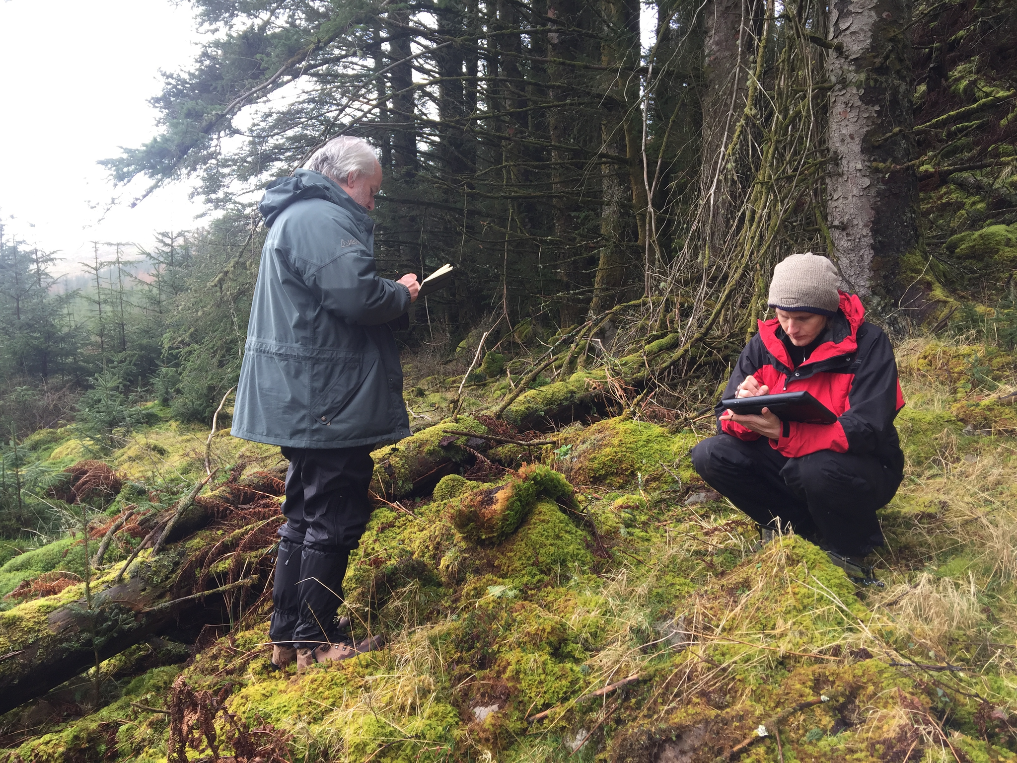
We began our own survey within a fluid exploration that aimed to reflect our particular disciplines and the necessary demands of applying our techniques on a landscape scale. We embraced the opportunities for critical reflection on processes – an opportunity to consider practices that are taken for granted – signification and meaning/interpretation through our creative assemblages of shared experiences walking the landscape, note-taking and site writing (Rendell 2006), photography, conversations, and sustained dialogue on-site, and between our respective disciplines (c.f. Pearson and Shanks 2001; Shanks 2012).

We allowed encounters and discussions in the field, followed by later periods of reflection, analysis of our results, and questions that would shape our future approaches. This was moulded increasingly through dialogue before, during, and after fieldwork and within the context of the recently expanded Art and Archaeology creative practices (Thomas et al. 2017; Russell and Cochrane 2014; Bailey 2014, 2017). This unfolding development of our research has not reached a conclusion and doesn’t aim to, rather its purpose is to provide a complementary approach to RAMP and other contemporary landscape-scale archaeological survey and mapping projects (Lee 2018; Coppes and Lee 2018; Palsson and Aldred 2017; Pearson 2017; Gillings et al. 2018; Cohen and Duggan 2021).

With spade, trowel and total station set aside, and with no physical objects actually collected, we considered how experience might usefully affect, open, and re-wild the language of the inventory. The digital files become text, image, and archive: our only reclaimed artefacts for a national record. We also dissected how our shared practices in dialogue might significantly expand the documented and archived experience of the few days spent at Kilmartin. Whether, too, this form of art/archaeology can achieve an expanded, landscape-scale entanglement. How in effect might site walking, site writing, dialogue en-route coupled with the phenomenological experience add to a more encompassing picture of a space that embraces place, time and the poetic, a ‘deep map’ of the landscapes and their potential (Heat Moon 1991: i)? And how might this create, in the process, a series of works as reflections that lie within, but also move beyond, the academically defined boundaries of either art or archaeology: a mutual working together that seeks to usefully (not wilfully) disarticulate, repurpose and disrupt conventions of meaning (Bailey 2017)? The ‘reductive duality’ [1] of a ‘truth’, the analytic site-document, for example, versus a non-scientific, romanticised or poetic depiction of place was challenged to illustrate how truth and poetry may be shown to reside within the disciplinary languages of both specialisms. Through our chosen approach to blending evidence with expression, we hoped to produce a work that would suggest humanity’s toe-hold on the landscape as a fluid thing. A toe-hold or trace that acknowledges both a presence and an absence without fixed (or immutable/formalised) links between the past, tradition and the contemporary space of meanings. This exposition, therefore, reflects our individual practice through writing, and the qualities of image and text as image, with the overall design and layout of the exposition illustrating our commonalities and the margins of our individual practices.

The Kilmartin and Knapdale Survey Area showing the track lines (in black) that record the movement of researchers during fieldwork in 2019. (Crown Copyright: HES).

Mapping as drawing, as feral text. Kilmartin Glen, 13th March 2019.

Landscapes and Mapping 

The RAMP Kilmartin survey gathered data through desk-based assessment, combined with fieldwork, data analysis and interpretation. This led to an updated NRHE, including an archaeological map of Kilmartin with accompanying descriptions of sites, improved location accuracy and additional photographic records (for further details see NRHE). Within the context of archaeological survey, there is an underlying opportunity for HES, which is charged with the creation of robust datasets, along with the curation of the archive and a recognition that multiple narratives of the past and present exist. There are a wide range of contemporary examples of how this approach is being undertaken (Richardson and Almansa-Sanchez 2015; Schofield 2017; Hale 2020). 

HES has worked with communities of interest for many years to incorporate their archives in the NRHE. For example, ‘Discovery and Excavation’, ‘Scotland’s Rural Past’ and the National Lottery Heritage Funded Scotland’s ‘Urban Past’ project have all contributed information to the archive. In addition, through co-design and co-production projects, communities of practices have been enabled to explore, expand, record and archive aspects of their heritage (Hale et al. 2017). So, the RAMP Kilmartin survey presented itself as an opportunity to develop this approach to enabling and expanding understandings of what contemporary mapping of landscapes could become through collaborative projects.

Jim Harold (left) and Lukasz Banaszek work with pencil and computer. 13th March.

Since the 1970s, the practice of landscape archaeology and its attentive mapping has advanced along with theoretical developments (Fairclough 2008), in large part due to the application of software such as Geographic Information Systems. Although these systems and the tools that provide datasets to be analysed within their digital environments (e.g. LiDAR) appear neutral, they have been considered within post-functionalist frameworks, to enable specific social readings of landscapes (Wheatley 1993; Harrison and Schofield 2010: 79-86). In this arena of archaeological mapping we should also consider scale and the potentially constricting, over-reliance on specific points on a scale: ‘artefact, site, landscape’ (Harrison and Schofield 2010: vii). Within post-modernist approaches and our expanding conceptualisations of the Anthropocene, archaeological mapping can take us beyond those familiar scales and enable broader conceptions of landscapes past, present and in the future (Shanks and Pearson 2001; Edgeworth 2013). It is within this expanded field of landscape mapping that our project both sits and takes its inspiration. 

Kilmartin’s landscape, like all landscapes, is a palimpsest where the past and present – from deep to current time – are held, each layer blurred and absorbed but not totally overridden, by the later layers. Analysis of the LIDAR survey data, along with historic maps and NRHE information have revealed anomalies on the surface of the land, in some cases veiled by vegetation, that have slipped from view. While there is a beautiful precision to LiDAR’s gaze, an authority given by the governing technological purpose of its origins in military technology, it is not totally precise. Interpretation is still needed, as is verification in this case – a witnessing – through physically walking from ‘target’ to ‘target’ on the surface of the land: dodging through woodlands, across boggy ground, around bushes and over scrub. Marrying the possible name and type of object on the screen with archaeological knowledge and reading in the presence of the thing itself, or its absence.

Alex Hale: photographing lichen growth. Site of felled logs that turned out to be a false positive in the ALS dataset. 12th March.

No inventory or map, however, is ever complete as Jorge Luis Borges reminds us in his one-paragraph fiction, ‘On Exactitude in Science’ (Borges [1946] 2000: 325), which offers a salutary reminder of the impossibility of a total or all-encompassing map - one so detailed as to require a one-to-one scaling that covered the very landscape its makers sought to plot: the un-wieldiness of its form leading to its inevitable abandonment, with partial tatters of map symbolically lingering in remote nooks and crannies of the land. Taking Borges’ point, no mapping process can or should ever be complete, total. Rather, each map acts as a condensation and editing process predicated by a particular focus or mode of enquiry and should, therefore, be viewed as one layer or armature within a broader discursive schema for the organizing of spatial practice (Martin 2011: 147). 

Many maps or mapping sets, however, based upon a variety of approaches and models provide palimpsest-like layers, one layering upon another - that enlarge and complicate perceptions of place and site. To this end the layered processes of plotting and fixing locations, and those related to the gathering of textual data for the inventory, were complemented by our further distillations, quasi-maps that articulated the physical experience of walking the landscape, memories of the days, notes, photographs, poems and free-hand drawings. Each acting as a further layer of interpretation and experience: physical in some cases and non-material in others.

View along the edge of an area of Sitka planting. A 20th-century monoculture crop. 13th March.

View across the remains of afforested land near Ormaig. 12th March.

Path-side debris and brash, near the site of Ormaigs cup and ring marked-stones. 13th March.

Language, an opening and ‘wilding’ of the inventory/archive

Language may, in a primal and formative sense, be perceived as a ‘raw and primitive being’ (Foucault 1970: 42). It may also be understood in the terms Maurice Blanchot discussed in his essay ‘The Sacred Speech of Hölderlin’ (1946) as existing in a difficult dynamic between its tendency towards abstraction and obscurity and the ideal of clarity. As such, the status of the word cannot solely be determined in the terms of information. Rather, it ‘arises from the silent origin of word and thing’ (Haase and Large 2001: 60). The origin of the word (of words) in their silent beginning also turns, as a consequence, upon their alterity. In this regard, writing cannot simply be viewed as the scratches or marks on a surface – whether that on the rock, the page or the screen – but as a shimmering interplay, the ‘flesh and blood’ (Derrida 1998: 159) of a something and a nothingness that dissolves any easy distinctions (Morton 2016: 80).

Sheepfold wall at Dun Mac Samhainn. 13th March.

Commentary and attendant meanings that have become circumscribed by an overarching institutionalised currency would seem, in the light of such views, to deflect away from the potential of language to re-assert the immediacy and mysterious linkage between the word and the object: between humans and the world at a formative level. A point picked up by Lyotard through the term ‘sensus communis’ (Lyotard 1991a), or common/public sense, that asserts a community of taste and meaning (Jones 2014: 105–106) that can effectively blind the reader to the raw primacy of the word or mark. A state of primacy that was so evident during our researches in the landscape around Kilmartin and, particularly, in the form of rock art found both in the greater landscape (Jones et al. 2011) and at the key sites of Achnabreac and Ormaig. Both are extraordinary locations that sparked on-site discussions about meaning or meanings that, in the absence of any knowledge of an original intent, can only remain obscure and unknowable to us now. Thoughts that, as we walked, could only provoke a state of disruptive silence: a blackout of thinking and a whiteout of knowledge.

So how should one read these marks? Literally or using intuition? Or, is this one of our many archaeological (and poetic) opportunities, when we are trying to read these marks literally when we may fail to see them and require an alternative approach that provides ‘a starting point rather than a finishing point for analysis, the textual inscription of an initial arc in a more hermeneutic spiral through which the subjectivity of the archaeologist and the objectivity of the rock carvings become fused in the production of a discourse’ (Tilley 1991: 114).

We consider the marks within the context of the performance of an unspoken language – becoming wild – that acts both as a socialising, ‘othering’ discourse between carver, populations and the landscape, bringing it into a human context while rendering it an unknowable and mysterious or primal thing in Foucault’s (1986) terms. By not turning our experiences, or sense perceptions, immediately into a recognisable language or, more pertinently, into a syntactical framework, there is the greater opportunity for those minor details glimpsed in passing, and so often lost within the whole, to find their importance and, in the process, to enliven both experience and meaning (Lopez 2019: 167).

Cup and ring markings, Ormaig. 13th March.

It is within a parallel trajectory of (graffiti) research that we explored an opportunity for a re-wilding of the Prehistoric rock art, the surrounding landscape, and our presence. On a glacially-striated sheet of outcrop covered by rock art or in a landscape context, how do we contemplate alterity, the white space, non-site or absent target? And how does this help us think about place, landscape, and time as fluid entities? Remember, consider and look for the ‘other’? Or is everything that landscape archaeology views a white space to be filled with black text? (c.f. Pearson 2017). If we consider for a moment the uses of these spaces, which we inhabit for a few days only, how do we perform a terrain that has seen forestry machinery, sheep and cleared occupants previously? What other humans and more-than-humans occupy these regions? Do we sustain the impermanence of these areas? And can we enable a sense of multiple occupations of such spaces, turning them into places?

Posing such questions also brings everything in this research towards the interpretive role of the ‘noun’ and the ‘verb’. It is here that the nature of language – that in the archive and that adopted by the poet or archaeologist – may usefully be articulated: the matter-of-fact use of names (nouns) alongside descriptions (adjectives) and actions (verbs). Further layers of the palimpsest to enact (Olson 1951: 15–26) or to become subject to the concept of the event as formulated by Lyotard (Sim 2011: 70–72). The act of projecting the word through the breath into the world that echoes the challenge of each breath as we navigated the steep slopes and tumbles of logging brash on the hillsides of Kilmartin Glen.

In this regard, cultural constructs (or the conceits of language structures) may become an impediment to our seeing ‘the dignity of nature’s strangeness’ (Wirth 2015: 21, our emphasis) and the ‘true’ value of landscape as other, as ‘unknowable’ other. A thing, an assemblage of things, that exist independently from human existence and language. Estrangement, rather than familiarity, may become the key rule of engagement here. But this is not a matter of alienation, if that word is considered only as a two-dimensional concept. Instead, it is one of continual and new encounter with a realm that is in a constant state of becoming: one of ‘instants’ and ‘beginnings’ (Lyotard 1991: 82), rather than one of stasis or entropy. They become, too, in Malpas and White’s words: ‘the very essence of language and world as they belong together' (2021: 115). As a reflection of such a landscape view, words themselves might be considered as approaching a secular form of apophatic language.

Part of a group of five clearance cairns (post-medieval) barely visible due to the overgrowth of moss. 13th March.

‘The poem is a sensual experience which gives voice to both the occluded interior and the occluded exterior; it is the […] “outrider” of […] the “unconscious” and the “noumena”’ (Byrd 1980: 70).

With landscape no longer considered as being circumscribed by a static sense of place – itself a critique of the Romantic view of a sense of place, we, like it, become in Lyotard’s terms the landscape’s ‘lost traveller’ (1991a: 219), and place becomes not only less familiar, but uncanny (Morton 2010: 50).

For us, movement and fluidity – whether physical or intellectual – became key factors defining our encounters on the survey and we found ourselves moving through a series of landscapes, become spaces of liminality. Uncanny hinterlands, both literally and metaphorically, which briefly cohered in the terms of the survey, its language and data (the fixing of place), only to then slip towards an unknowable sense of place and experience towards, in effect, another form of knowing in the terms of an imagining of place (Brind and Harold 2018).

A Wilding of the Word through Actions

As our practices unfolded during fieldwork and post-fieldwork meetings, a place developed within our respective disciplinary margins which at first seemed small, yet fertile. Since the fieldwork, during discussions, drafting texts and taking food together, potential ideas grew within this marginal space to reveal a necessity for our practice to free the text, language, and meaning of the inventory within and beyond the national archive. During our discussions, it became clear, too, that we must acknowledge and, in some small way, incorporate current discussions and actions designed to consider the deep structural issues that both archaeology and other disciplines have recognised and are addressing, such as gender (Moser 2007), photography and imperial legacies (Azoulay 2019), and acts of colonial violence (Hicks 2020). In its own part, fieldwork can be seen as an extension of military subjugation through survey and mapping practices previously applied to repress local populations. Specifically, and in connection with ongoing photographic and LiDAR-driven surveys, we recognise that these approaches can be applied beyond their original purposes and through critical reflection, with the intention of positively and sensitively expanding our relationships with landscape, place, each other and more-than-humans.

On reflection of the physical landscape of Kilmartin Glen, our observations of commercial forestry, farmland and rough grazing lands, and combined experience led to talk of ‘wild’, ‘tamed’, ‘domesticated’, and ‘devastated’ topographies. But it was after our departure from the landscape that we began to surface the potential for re-wilding, not in the scientific, nature conservation sense (cf. Lorimer et al 2015), nor within the contexts of how archaeological remains are being considered within the re-wilding agenda of landscape management (DeSilvey and Bartolini 2019). Rather, ours is an attempt to surface, explore and to reflect on the multi-scalar potential of wildness across landscapes, both topographical, linguistic, and imaginary.

In this way, we recognise the need for a wilding of language in the archive that allows for and encourages a re-imagining both of archaeological landscapes and of the poetry of landscapes: one that steps beyond any reductivism, consequent upon the traditional condensation of language in the terms of categorisation and inventory. In effect, a stratagem that seeks to engender a dynamic and fluid sense of language, its value within the world and to knowledge systems, that reflects its formative state as a ‘raw and primitive being’ (Foucault 1970: 42) and its elusive meaning(s) arising from ‘the silent origin of word and thing’ (Haase and Large 2001: 60) – not a domesticated or fixed thing, but a living and vital form of continual enactment, mirroring the world of natural phenomena.

‘We think we know what to expect from the world we live in and miss the opportunity to see things not only for what they are but also for what they are becoming. New worlds open up every day, [Italo] Calvino observed, and we fail to notice them’ (Farrier 2020: 152).

Entanglements of briar and woodland, Ormaig area. 13th March.

Future entanglements

'I constantly came up against a borderline where I felt, well, if I could go a little further it might get very interesting […] That temptation to work with only very fragmentary pieces of evidence, to fill in the gaps and blank spaces and create out of this a meaning that is greater than that you can’t prove, led me to work in a way which wasn’t determined by any discipline' (W.G. Sebald quoted in: Bigsby 2001: 152).

Mapping methods are always designed to record certain facets of landscapes (topographical, political, economic resources, population data, etc.) and will always omit other aspects. But with the digital ‘turn’ (Perry and Taylor 2018), exemplified here by RAMP through LiDAR datasets and automated extraction, some of our opportunities to explore these landscapes are repeatable and recoverable. Whether we choose to do so is another matter. These methods also provide us with the potential to expand the range of locations and objects/points of scrutiny to encompass and question what might or should fall within the remit of a contemporary archaeology: one where exclusion from the list and map becomes as telling as that which is embraced.

Was the work undertaken in Kilmartin so rapidly that we missed specific aspects of the archaeology? Undoubtedly, because our conceptualisation of archaeology should be an expanded assumption, rather than one that restricts the definition to the formal inventory. The archaeological survey brief was specifically designed to exclude aspects of the landscape that could be considered as ‘archaeology’. For example, more recent features of human-landscape interactions (active agricultural systems, quarries, roads and contemporary human habitations), along with all their attendant structures (e.g. telecommunications infrastructure, drainage systems), and our own passage and presence in the landscape, much of which have been considered as appropriate archaeological subjects through approaches to the contemporary past (Graves-Brown et al. 2013; Harrison and Schofield 2010). And so we hope to have offered practices that acknowledge potential exclusions and open up space for reflective observation, the potentialities for tentacular thinking (Haraway 2016: 30), recognition of deeper human and non-human entanglements within the Kilmartin landscape through serendipitous (and/or synchronic) opportunities and the opportunities for deeper entanglements with complex palimpsests of actions, ruins, and systems of living.

W.G. Sebald’s words at the start of this concluding section appositely present a case for the crossing of borderlines, be they imposed externally or by the self, as a part of any creative or other form of enquiry. We, in our turn, very deliberately decided that the margins of our respective disciplines could provide the most fertile ground for exploration. Each of us brought the gathered fragments of experience and knowledge derived from our individual disciplinary bases to bare both upon the subject and location at hand: the lands, the experiences and the archaeology around Kilmartin Glen.

In considering the different marks on the landscape, their messages, and potential meanings, we would argue that our shared intellectual aims and interests enable us to re-introduce the potential for divergent modes and applications of language to become poetic (wild) languages, whether they are part of the archive or the wilderness. We read, for example, prehistoric carvings and considered their potential as graffiti, as a free text which is neither official nor sanctioned, an artefact free from the archive. We read the marks on the landscape as languages that have no page formatting or margins, that are in effect free of overt domestication characterised by Lyotard in his term sensus communis: the normalising of language and meaning. A domestication or normalising of language that may, on the one hand, bring things to our attention; while, on the other hand, cause them to become familiar or commonplace – a form of forgetting in itself.

The view north from Bàrr an Daimh, looking across Mòine Mhòr towards Kilmartin. 11th March.

The Kilmartin survey’s remit, as already noted, was not to collect physical artefacts, but to focus instead on the written or digitised word, the grid reference and the confirmation or not of a find. This opened a door for an analysis of the comparative use and value of languages and media within the context of a survey and the archive. Where many other Art/Archaeology projects have focused on the material (the object/artefact), our research explored the phenomenological experience and language as artefact: a signification and chance to wild – maybe also to ‘weird' (Morton 2016: 5) – things that in many senses are being domesticated towards a form of extinction. As such, and following the broader research project’s remit, we focused on the use of language as a means of both a description of experience and of scientific data – poetic form and document.

In effect, we considered the potential of the different scales of entanglement that are explicit and implicit in a survey like that at Kilmartin Glen and, by projection, any similar survey. In the process, we have sought to identify and value those qualities that may be found within and between the intertwining scales and entanglements of language as they are adopted by the survey and the poetic, whether presented as text or as image and in the terms of place. Not, however, a fixed sense of place, but a place like that indicated earlier in this text by Lyotard, or more recently by Morton, as both a fluid series of events (Lyotard) that are freed of any ‘reliable constancy' (Morton 2016: 5). A place of movement, intersections, scalar diversity and signification. A place, many places at once, that may be found equally within the environments of the archive and the landscape: within the word, on the page, at one’s feet, under a rock, amongst the undergrowth, beneath the earth, in the document, in the poem, before one’s eyes, in a sound, in the instant, in the multi-valency of place and places. In this regard, place – like words and poetry, bends and twists (Morton 2016: 11) – folds and unfolds to reveal its intrinsic otherness. Lists, such as those we are using in these concluding thoughts, neither act as hierarchical, nor linear entities, but as loops. The wilding of language revealing an otherness – the ruin within language – as it enters the archive that is devoted to the discovery of and articulation of the ruin.

The acknowledgement of the role of language as a significant locus for the wilding of meaning opens up the possibility to re-appraise how experiences and our worldview are shaped in relation to landscape, archaeology, and art. The concept of wilding demonstrably expands the possibilities of the idea of place and places, rather than closing them down. It quite simply allows us to see things differently and strangely. For the authors, the idea, sensation and experience of place – not space which can be both conceptually and physically colonised – is such that it contains both the experience of our meaning(s) and their otherness. As our research has developed we have begun to consider that there is a further potential expansion of the concept of a wild or wilded language which we consider might be termed as a ‘feral language’. This is a mode of expression that steps further away from any comfort zone that might normally be made possible by our conventional or domesticated usage and acceptance of language (Harold 2020) to engender a further and more nuanced state of estrangement for the participant (Wall and Hale 2020). We became familiar and comfortably uncomfortable through our collaborative practice during the fieldwork and as a result of subsequent calls, meetings and research. As such, the drifting form(s) of a wild become feral practice and language acts like a mesh of relations and indicators and, by so doing, alters our scales of reference from the smallest thing and word to the largest scale: from word to sentence, to paragraph, to essay, chapter or book.

In conclusion, it is in this spirit that we consider our future entanglements should move between the differing scales of engagement, from the material constituents of the archive (the word, the document, folio, acid-free box, the shelf and the institution) to that of the landscape, with its close details (the undergrowth, the site, vague structures, the ruin, etc.). A matter of breathing inwards and outwards towards the larger parameters that are defined by geology, landscape, land-use patterns, the horizon line, or the overarching weather systems. Within our collaboration, we consider our practices to actively expand our disciplines which, at times, we hope can be constructively provocative. We shall continue to identify and contrast a select number of locations that cover a range of sites from the historical to expanded forms of heritage and new heritage sites in terms of the complexities of language, description, and the environment. Such surveys allow for the potential to engage further with curious confabulations, and human and non-human entanglements, through tentacular processes, practices and chance. 

Postcript Monday 5th December 2022

From Cowp to Nature Reserve: an ongoing research project since August 2021, between Susan Brind, Jim Harold, Alex Hale, other voices from the locality including academics and partner organisations.

Hamiltonhill, Claypits lies just to the north of the centre of the City of Glasgow, Scotland. The place is a palimpsest with traces from pre-agricultural landscapes to industrial and, now, post-industrial uses. We know from the maps that we have consulted, dating from the eighteenth century to the present, that the landscape became a parcelled-up and owned place by, amongst others, the Hamilton Family. These early maps depict the place comprising agricultural land, which then turned into a C18th/C19th canal-side and industrial hub. Following this period in the mid-C20th, it became a post-industrial landscape colloquially known as ‘the Cowp’ and, in architectural terms, as a ‘terrain vague’ (de Sola-Morales 1995) or neglected space. During 2021 Claypits has become an eco-site and local nature reserve. It is now a place of leisure, a local resource, and a thoroughfare directly connecting the community of Hamiltonhill with the city.

Building on from the research described above at Kilmartin, the aims of this new project are to continue our speculations as method by exploring collaborative practices. The necessity of speculation within our work aims to become a process that enables our individual disciplinary practices to combine, contrast and create new ways of thinking within a landscape. For example, our explorations of archive within the landscapes of Hamiltonhill. This can manifest through listening to and giving voice to the multiplicity of narratives that the landscape can elicit: for example, the underlying social, colonial and imperial languages hidden, explicit and encapsulated in the landscape. Underlying this project, we acknowledge the urgent need for ontological shifts within our disciplines. However, we do not consider our speculative approach to redefine our disciplines and subject areas, rather to expand them for future applications.

[1] From Alex Hale’s notes from a seminar at HES (June 2019), and with reference to a direct use of the dialectic made during a #3M_DO_2019 meeting, Edinburgh (December 2019).