
A Canary says to you:
Anytime you see text within these frames the text continues to scroll down. Use your mouse scroll wheel, laptop touch pad, or swiping up and down on your mobile device to scroll. You can also use your keyboard's up and down arrow keys after clicking once on the text block first. On the following pages to get back to the exposition map from any pop-up pages simply click outside their bounds and be patient. If you get lost in the darkness, don't panic, just use the map at the top of your browser window under 'Navigation' find your place.
Abstract
The mountainous geography of Appalachia has been shaped by the coal industry since the post-Civil War
Reconstruction Era of the United States. Mountaintop Removal (MTR) is a controversial and highly destructive surface mining method that has been flattening the mountains of Appalachia since the 1970s. As demand for electricity and steel production increased worldwide, the mountains were blasted and flattened with dynamite and heavy machinery. The massive consumption of energy with the rise of consumer electronics, automation, and technocratic neoliberalism have irrevocably un-shaped the geographic skin of Appalachia and with it the people living in its wrinkles.
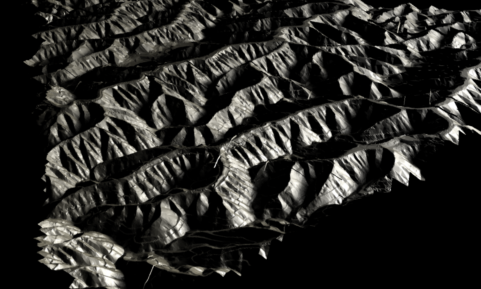
Reclamation is the final act in MTR mining in which the mine operator is required to restore the land ecologically. Is the ship of Theseus the same ship if you only build the bow assembled from the bones of its crew? The mountains cannot be returned after being ravaged and pushed into the valley. Where mountaintop removal sites were once hidden away from the view of the highway and even photographing them was considered an act of trespassing, today I can bear witness to the destruction of the mountain topology by connecting myself via the network, through Google's Earth (not to be confused with earth-Earth). Geographic information data (GIS) and Light Detection and Ranging (LiDAR) scans topologize a 3-Dimensional quilt over the mountains' compressed layers of dead carbon. Despite the remote locations and inaccessibility of the sites, the data material here is particularly rich due to the advantages of mapping such an area in the industry.
In this exposition, I make my own reclamation as one of the generation of Appalachians born after the boom of coal production and its inevitable decline. I am reclaiming the 3D geospatial data of MTR and mining disaster sites extracted from the servers of Google Earth to tell the stories of disaster and fatalism played out upon the stages of family, career, and industry.
I recontextualize these geospatial assets to compose a visual prosopography with those surfaces. I reflect on how I escaped my fate born in the coalfields of West Virginia.

As the number of coalmining jobs has been on the decline since the 1970s with the new practice of mountaintop removal mining [MTR], the mine wars' shaping of worker's rights,[4] and coal mining disasters are generationally eroded in cultural memory by a memory-shocking barrage of electronic information in the forms of information, entertainment, and light. (Crary 2014). My work and research is driven by a desire to visualize the fatalism embedded within the reoccurring disasters, emergent in and through Appalachia's rich literate and oral forms.
Using Google Earth, you will find their GIS and LiDAR data compiles into a 3D modeled topography that is especially detailed over coal mining regions. Although Google does not make downloading their 3D geometry available, I developed a handy workflow for grabbing the topography while it is rendering in the software as data is transferred from Google's servers to my personal computer. The script is based on an open-source tool available on GitHub called GLIntercept that is commonly used to nab 3D models from video games with server-based assets such as Mass Multiplayer Online RPGs (i.e. World of Warcraft). (Horning 2014) It was primarily developed for video game modification communities. This hacker technology allows me to grab a snapshot of strip mine site 3D models from Google Earth's servers. The script, therefore, exports a model whose focal point is finely detailed with the strip mine's flattened surfaces and access roads clearly defined, fanning out into a still-rendering low-polygonal flattened version of the landscape on the outer edges in the cone of vision, a mimetic display of reality.